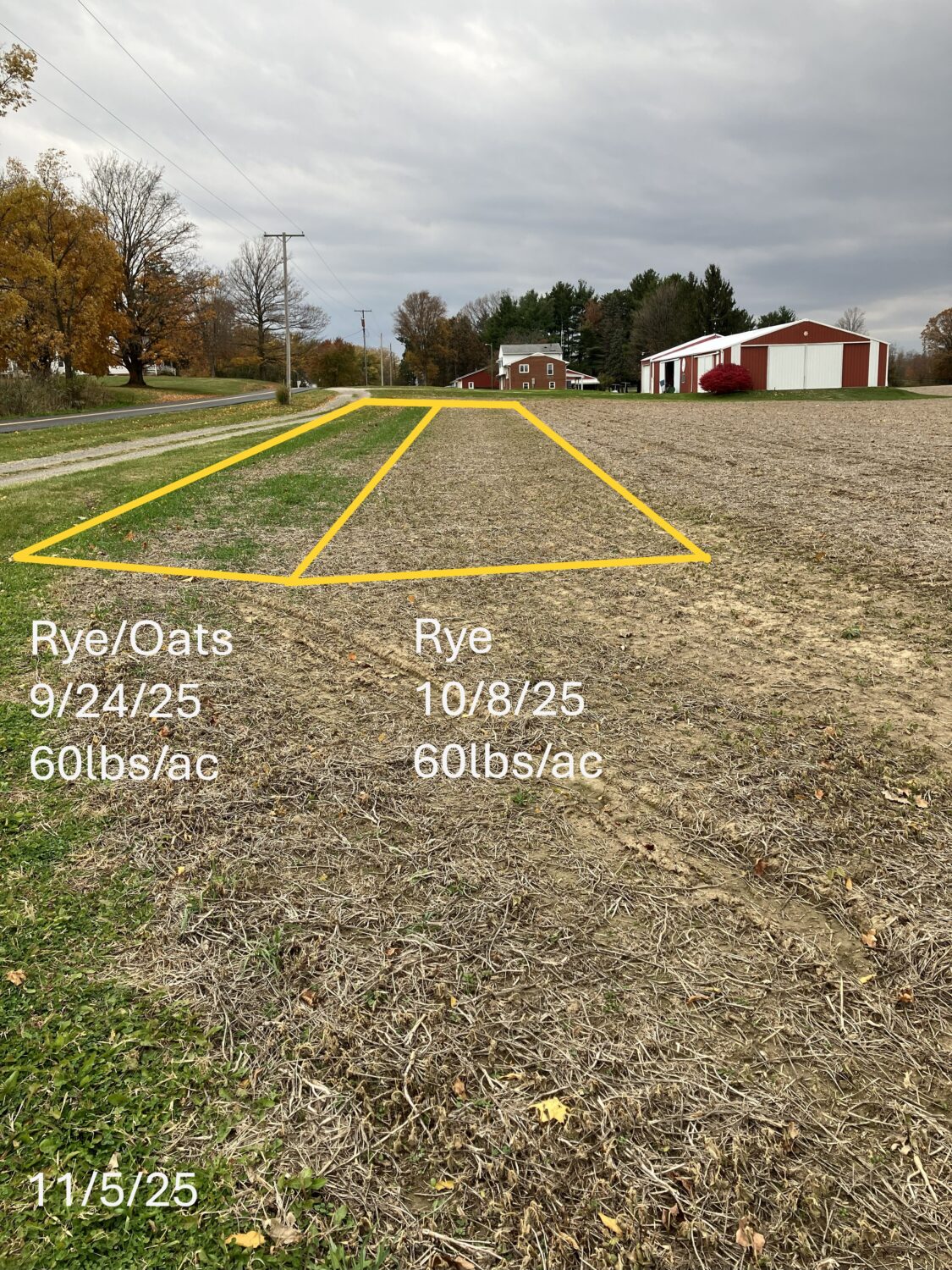
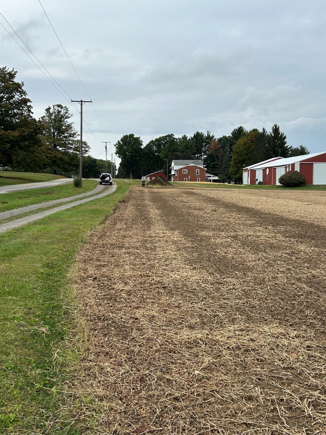
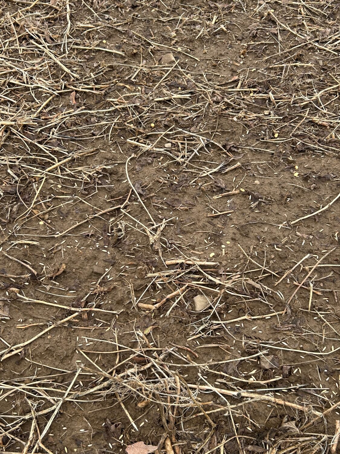
As the 2025 planting season is (hopefully) winding down, we’re also winding down on our 2025 practices. This will ultimately bring our first multi-year H2Ohio contracts to an end. If a producer is interested in continuing with the program in 2026/2027, there is some important information regarding cover crops after 2025 harvest. There are a couple of options/scenarios to consider:
- If planning cover crops this fall for your current H2Ohio contract but you do NOT want to re-enroll for Crop Years 26/27 (CY26/27): You don’t need to do anything other than let Jordan know you won’t be participating in H2Ohio for CY 26/27.
- If you’re planning cover crops this fall and you plan on enrolling in H2Ohio for Crop Years 26/27: Let Jordan know. We’ll need to do a termination agreement after all other 2025 practices have been completed. This will cancel the cover crop practice for CY25 on your existing H2Ohio contract and we’ll enroll those fields for a CY26 Cover Crop under the new H2Ohio contract for CY26/27.
The benefit of doing things this way: The existing contracted payment for an overwintering cover crop is $25/acre. That same ground going into a cover crop this fall on a CY26 contract will pay $40/ac for cover crops on the same date you’d expect to start seeing payments go out on an existing contract CY25 cover crop (i.e. after March 15, 2026). A difference of +$15/ac for the same ground paid at the same time you would have received a CY25 cover crop payment.
Crop Year 2026/2027 Manure Update
2026/2027 Manure Incorporation & Utilization
If you’re planning on enrolling in the manure incorporation & utilization practice for CY26/27, there have been some changes from the current contract’s practice standard for manure incorporation. The practice is now called manure incorporation & utilization and has added ways for no-till operations to receive a manure utilization payment. Please take a look at the practice standard on our website or contact Jordan for a copy if you’re considering manure incorporation/utilization in CY26/27.
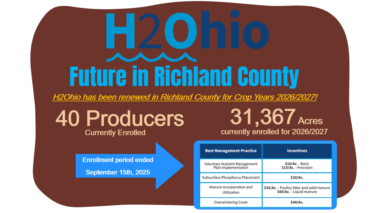
Signups for H2Ohio Crop Years 2026/2027 (CY26/27) Continue Through Early August
The application for H2Ohio CY26/27 is available now on our website. You can also email Jordan for a copy or with any questions about the program.
Contracts for CY26/27 will start rolling out in late August 2025.
Please submit your application and begin gathering the following information for nutrient management planning and development on the MyFarms platform:
- Up-to-date soil test information (i.e. 4 years old or newer). For CY 2026 soil test information from 2022-on are acceptable, for CY 2027 soil tests from 2023-on are acceptable.
- Planned crop types for CY26/27.
- Field maps for the eligible ground you’re interested in enrolling in H2Ohio (or field boundary files from your CCA or agronomist.)
- Prescriptions or fertility plan for CY26/27.
*The soil test data, crop rotations, field boundaries/maps and fertility plan aren’t required to be submitted with the application, however, this information will need to be submitted prior to the contracting period coming August 2025.
Also available on the website are the practice standards and work plans for CY26/27. The practice standards are the minimum requirements that producers need to meet in order to receive payment for completing the practices. Work plans were designed to help producers successfully implement the practices.
If you’re interested in enrolling in H2Ohio for Crop Years 2026/2027, please submit your application as soon as possible. There is an enrollment cap of 800,000 total acres in the Western Lake Erie Basin (WLEB) program area with the 2026/2027 contracts.
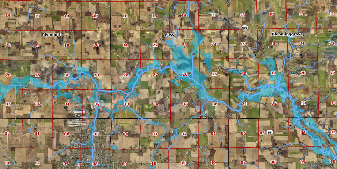
As a reminder, Richland County is on the WLEB H2Ohio schedule meaning acres in the following counties will be eligible to enroll through our office for crop years 2026/27: Crawford, Erie, Huron, Marion, Ottawa, Richland, Sandusky, Seneca, Shelby, & Wyandot.
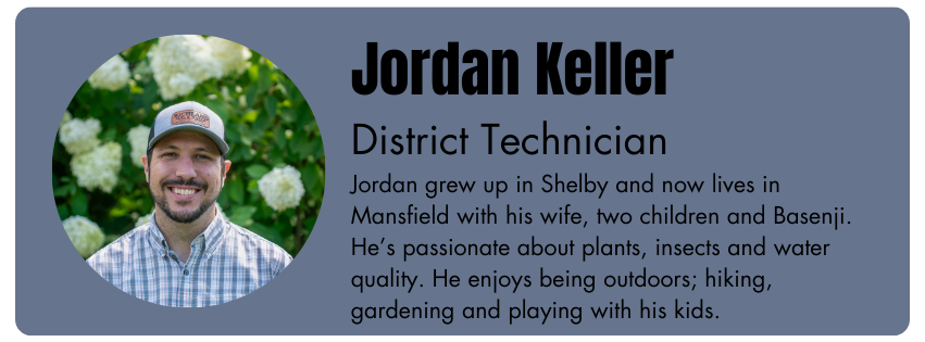
If you have any questions about the program or application, please do not hesitate to contact Jordan.