Back to Watersheds

View of Marsh Run as it crosses Sharp Rd. Looking southwest. Mike Mackey buildings are on left J.Sharp buildings are in the right. - 06/28/1962

June 28, 1962
View of Marsh Run as it crosses Sharp Road looking southwest
Mike Mackey's buildings to the left
J. Sharp's buildings to the right
Photo ID#: W101

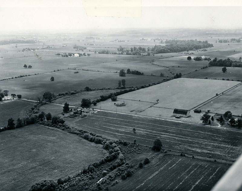
06_28_1962_View_of_Marsh_Run_as_it_crosses_Sharp_Rd._Looking_southwest._Mike_Mackey_buildings_are_on_left__J.Sharp_buildings_are_in_the_right._website-5130

Description

June 28, 1962

View of Marsh Run as it crosses Sharp Road looking southwest

Mike Mackey's buildings to the left

J. Sharp's buildings to the right

Photo ID#: W101

Category

Submit Info

If you have any more information to add about this photo, please tell us by filling out the form below. Thank You!

More Watersheds Photos

1990_Cedar_Fork_Tornado_clean_up__27_website-4769
1990 Cedar Fork Tornado clean-up #17-website
1990 Cedar Fork Tornado clean-up #12-website
06_28_1962_Marsh_Run_outlet_into_Black_Fork_River_southest_of_bridge_over_S.R._61_website3-5433
05_01_1962_Robert_Hilliard_SCS___of_Mansfield_presenting_Marsh_Run_II_Watershed_application_to_board_of_supervisors_The_Divide_SWCD_website-4796
06-28-1962 View of John Maurer’s strip cropping along Route 13 just north of airport-website